Mark Cruse
  • About Me
  • Blog
  • Photography
  • Cartography
    Digital Maps Print Maps
  • Search
Navigation bar avatar
✕

    Mark's Blog


    Curiosity Ignites the Quest
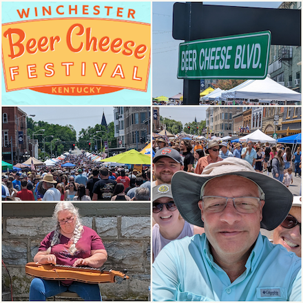
    • Embrace the Local Spirit - Quench Your Thirst and Satisfy Your Taste Buds

      Discover the Pleasures of Drinking Local and Eating Local

      Posted on June 23, 2023

      Post thumbnail
      Post thumbnail
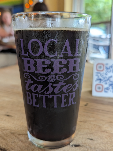
      Tonight we enjoyed local brews from West Sixth Brewery and dinner from Smithtown Seafood, which serves delicious food made with locally sourced ingredients. [Read More]
      Tags:
      • brews
      • food
    • Publish Local Jekyll Site to Github

      A guide to create a Github repository and publish to web.

      Posted on June 13, 2023

      A guide to create a Github repository and publish to web. [Read More]
      Tags:
      • github
    • Winchester Beer Cheese Festival

      Posted on June 10, 2023

      Post thumbnail
      Post thumbnail
      The 2023 Winchester Beer Cheese Festival was a resounding success, attracting a large number of enthusiastic patrons and vendors alike. The event buzzed with excitement as attendees reveled in the delightful variations of beer cheese. Families and friends came together, creating cherished memories and relishing the festive atmosphere. The festival... [Read More]
      Tags:
      • photoblog
    • Converting Raster Data to Vector Polygons for Map Evaluation

      A github repository to document the processes involved in converting raster data to vector polygons for map evaluation.

      Posted on August 9, 2022

      This Github repository documents the processes involved in converting raster data to vector polygons for map evaluation. It includes a Python Jupyter notebook that facilitates the transformation of National Land Cover Database raster data into vector polygons. The notebook automates several shell commands and incorporates processes to add JSON properties... [Read More]
      Tags:
      • github
    • Coloring Street Networks using OSMnx

      A guide for using OSMnx to download OSM data for a specific place and color the network of roads within that area.

      Posted on April 3, 2022

      Post thumbnail
      Post thumbnail
      This Github repository demonstrates the usage of OSMnx, a Python package, to download OpenStreetMap data for a specific location and color the road network within that area. It provides functions to assign colors and line widths based on highway types. The code creates a networkx graph from the OSM data,... [Read More]
      Tags:
      • github
    • ← Newer Posts
    • Facebook
    • GitHub
    • Twitter
    • Email me
    • Mastodon

    Mark Cruse  •  2025  •  Edit page