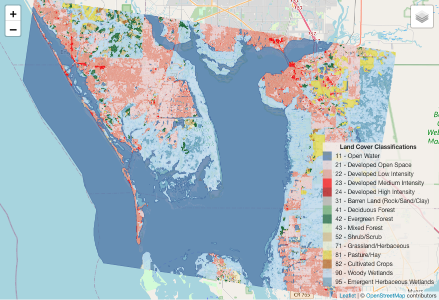
The map presented here represents the final outcome of procedures developed by Mark Cruse for transforming raster data images into vector polygons. You can click on the image below to access the interactive map, while the Python notebook and GitHub repository provide detailed insights into the underlying processes.